
Saginaw Neighbors Block Sources
Public sources describe parcels and records, not a complete social map. CAID can place an address among nearby parcel boundaries. TAD can return the owner and mailing fields for one parcel. County Clerk records can add recorded instruments and plats. A historical directory may show a past occupant at an address. The voter tool confirms a known registration but has no verified public web route for browsing an entire block.
| Block source | Useful result around an address | Access path |
|---|---|---|
| Tarrant County CAID | Parcel boundaries, account or TAXPIN, map and legal context | Public map; pan and click one parcel at a time |
| Tarrant Appraisal District | Owner, mailing field, situs, legal description, account, map | Free current parcel search |
| County Clerk Official Records | Recorded parties, plats, liens, easements, powers of attorney | Index and copy routes; no title determination |
| Tarrant Voter Lookup | Status and districts for a known person | Name plus date of birth or VUID, with confidentiality limits |
| Regional criss-cross directories | Dated address and occupant clues | Library or archive holdings; Saginaw inclusion varies |
Owners and occupants are separate categories. A parcel may name a trust, business, estate, attorney, or past owner. Mailing information is for tax correspondence, not proof of who is inside a home. Record the source and date for each parcel instead of treating a map label as a current household statement.
Map Saginaw Neighbors by Parcel
CAID is the starting map for the immediate block. Its inspected controls include Main, Google, and Bing search modes, an address field, Property Information Search, Layer List, facilities, links, and map navigation. The map carries a general-reference warning and the research did not verify a one-click neighbor export, buffer, or radius tool. Work clockwise from the target parcel and make a small manual inventory of adjoining polygons.
Tarrant County CAID GIS is shown below with the address, property-information, and layer tools that support this parcel-first method.
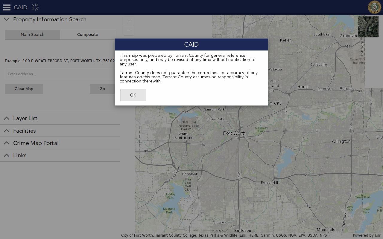
After a parcel click, move to TAD for its account and ownership fields, then use the legal description or instrument at the County Clerk only when an ownership-history question remains. A polygon touching another polygon shows adjacency, not a personal relationship.
- Search the target Saginaw address or pan to it, then turn on parcel or property information.
- Click the target and each adjoining parcel, recording the account or TAXPIN, situs, legal description, and map reference.
- Open a separate TAD record for every parcel and preserve the owner and mailing fields as stated, without calling either an occupant.
- Use a subdivision, block, lot, or instrument in Official Records when a plat, easement, or title sequence needs context.
- For a full named-street trail, use the Saginaw street directory rather than extending a block inventory into a street-wide resident list.
Saginaw Neighbors Parcel Keys
Legal description is often the best bridge when an address spelling, city label, or postal detail changes. TAD exposes account, site number, property address and city, primary owner, owner address, legal description, georeference, neighborhood code, map, and instrument fields. The sample Saginaw parcel at 813 Opal Street has a Saginaw situs but a Fort Worth mailing-city label, which demonstrates why city labels should be preserved rather than normalized away.
- Situs address
- The physical parcel address used in an appraisal or map record.
- Mailing address
- The address used for tax correspondence. It can be different from the situs and is not a current-occupancy finding.
- Legal description
- The subdivision, block and lot, or other land locator used in title records. It can remain useful when a street label changes.
- TAXPIN or account
- A parcel identifier that helps carry a map result into the appraisal record.
For example, Rancho North Addition, Block 24, Lot 22 and georeference 33470-24-22 are searchable-style parcel clues from the documented sample. They should be used to verify a parcel, not to create a list of people connected to it.
Note: Keep the situs, mailing, and legal-description fields separate because each one describes a different part of the parcel record.
Saginaw Neighbors Recorded Block Context
Recorded instruments can explain a block without identifying its private residents. The County Clerk’s Official Records search supports a term, recorded-date range, and index-only or index-plus-OCR scope. A legal description, subdivision, block and lot, or instrument number is usually more precise than a broad street-name search. Search results may lead to deeds, plats, liens, easements, or powers of attorney.
A plat or easement may explain a shared drive, subdivision layout, or access corridor. It does not establish who socializes together or belongs to a community group. The County Clerk does not conduct a title or lien search or decide restrictions, so use a recorded image and the appropriate copy route to verify a document when needed. The Central Library room B30 offers public kiosks and staff assistance for several County Clerk record types.
Saginaw Neighbors Voter Boundary
Texas voter information has a specific public and confidential split. The Tarrant tool can confirm a known registration through a name and date of birth or a VUID. Its result labels include name, address, voter status, precinct, and district assignments, while election history shows elections participated in, not ballot choices. The inspected public interface did not expose a lawful web search for every voter on a block.
Election Code §18.005 leaves protected residential addresses and certain identifiers outside ordinary display. The full voter-file route, format, price, and conditions must be obtained from Tarrant Elections rather than assumed from the lookup screen. Do not use a parcel location to guess a voter match, and do not turn district information into a claim about a household.
Saginaw Neighbors Community Names
The Saginaw Parks Master Plan identifies six HOA-associated communities. These names are practical map and deed terms: they can help locate a park, subdivision, plat, public notice, or publicly posted contact. The plan does not publish member rosters, and no inspected official source established a public directory for residents of any of the communities.
| Community term in the city plan | Appropriate block-research use |
|---|---|
| Courts of Willow Creek HOA | Compare with a subdivision or public amenity reference. |
| Commons at Willow Creek HOA | Use as a plat or map search term. |
| Creekwood HOA | Use to orient the parcel context. |
| Heather Ridge Estates HOA | Check a legal description or public meeting reference. |
| Spring Creek HOA | Locate public park or association context. |
| Willow Vista Estates HOA | Verify the current spelling before contacting an association. |
The City Parks Master Plan is a community-facility source, not evidence of membership or household identity. Private association files, delivery information, and utility records stay outside this research method.
Note: A community name can orient a map or deed search, but it does not identify the people who belong to an association.
Saginaw Neighbors Tool Comparison
Official records and commercial neighbor tools answer different questions. A commercial category may combine marketing data, self-reported information, old directory feeds, and parcel facts. That can be useful for a lead, but it can also merge people with the same name or carry a stale address forward. Use the custodian record to test any result.
| Source category | Best use | Limit to keep in view |
|---|---|---|
| Official parcel and deed sources | Verify parcel, legal description, recorded parties, and dated instruments | Owner or party does not equal current occupant |
| Official voter source | Confirm a known registration with permitted keys | No public block-browse route and protected fields remain closed |
| Commercial compiled tools | Generate a lead to corroborate | May be stale, merged, incomplete, or inaccurate |
| Association and community material | Find public amenities or contact channels | Does not show private membership or a household roster |
Saginaw Neighbors in Older Directories
Historic neighbors are a date-specific question. Fort Worth Suburban and criss-cross directory holdings can reverse an address to an occupant clue, but a standalone Saginaw directory series was not verified. Check the individual volume for Saginaw street coverage. Fort Worth History Center, Tarrant County Archives, and the Texas State Library have regional directory, map, newspaper, school-census, cemetery, and probate resources.
Search both an image and its OCR when a digitized directory is available. Older records may say Dido, the earlier name for Saginaw, or use a rural route, railroad description, or Fort Worth-area address. Preserve the volume, year, page, spelling, and whether the result came from text recognition or the page image. A historic entry is a snapshot, not a claim about present Saginaw neighbors.
Saginaw Neighbors Privacy Limits
Renters, other household members, children, utility customers, delivery recipients, and DMV address holders are not a public parcel layer. Protected voters and Address Confidentiality Program participants require special care. The program provides a substitute address for qualifying survivors and must never be reverse-engineered through other records. Redact unnecessary identifiers, preserve the custodian’s wording, and correct errors through the office that maintains the original record.
Lawful personal use. Use Saginaw neighbors research for personal, historical, property, or civic context. Do not use it to watch, threaten, stalk, harass, or expose a protected person.
A narrow Texas Public Information Act request can ask a city department for releasable address-specific records by date range and record type. Ask for a fee estimate and the statutory basis for any withholding. Do not request a broad dossier about a person or attempt to convert public parcel context into private household information.
Note: Texas Penal Code §42.072 addresses stalking, and public access never permits intimidation or repeated unwanted contact.