
Trace a Saginaw Street Directory
Address research in Saginaw works best as a chain, not a household list. An owner shown on an appraisal card is a property connection. A parcel map shows where that connection sits. A deed can confirm the recorded transfer, while a voter match can confirm a known person at an address when the official lookup accepts the person’s identifying details. Historical directories add a dated address clue. None of those sources alone proves every current occupant.
- Standardize the complete address with USPS ZIP Lookup. Retain directional prefixes, suffixes, unit numbers, postal city, and the returned ZIP because a small formatting change can miss a parcel.
- Search the address in the Tarrant Appraisal District. Record the account or site number, situs address, legal description, current owner field, and instrument number when displayed.
- Open the same location in Tarrant County CAID GIS. Pan the block, click parcel polygons, and capture the account or TAXPIN and legal-description clues for each parcel being compared.
- Use the account, subdivision, block, lot, owner, or instrument in the County Clerk Official Records Search. Read the purchase deed before treating a title party as an occupant.
- For a known voter, use the Tarrant County Voter Lookup with the required name and date of birth or State Voter ID. For older occupancy, check regional criss-cross and suburban directory volumes.
Keep one parcel log for the street: standardized address, TAD account, CAID identifier, legal description, source date, and Clerk instrument. That audit trail makes a street-by-street record trail useful for family history, estate questions, and careful property research without turning a parcel field into a claim about a household.
Saginaw Street Parcel Keys
The Tarrant Appraisal District is the first current-record stop for a Saginaw street search. Its result screen separates the physical property address from the primary owner and the owner’s tax correspondence address. That distinction matters. The research sample for 813 Opal Street is a Saginaw situs but shows a Fort Worth mailing-city label, so neither city label should be silently substituted for the other. Appraisal information is a reference record subject to change; the recorded deed remains with the County Clerk.
| TAD field or control | Observed use for a Saginaw address |
|---|---|
| Select Property Type | Optional selector for Residential, Commercial, Mineral, or Personal Property. |
| Enter Your Search | Required query box paired with a search type. |
| Search type | Account, Site Number, Owner Name, Property Address, Property City, Legal Description, Subdivision, Geo Reference, or Neighborhood Code are documented routes. |
| Account and Site Number | Returned numeric identifiers that help carry one parcel into the map and tax tools. |
| Property Address and City | The situs, or physical parcel location, returned when present. |
| Primary Owner Name | Current appraisal owner field, which can be an individual, trust, or entity. |
| Legal Description and Instrument | Subdivision, block, lot, or another title locator plus a deed-search starting key when available. |
| Export and page size | Visible controls include Export and 25, 50, or 100 result views; the available export format and row cap were not stated. |
Search by address first, then try the subdivision or legal description if the street spelling fails. TAD also exposes property city, map, georeference, class, values, and exemption fields. A homestead or exemption flag is context only, not proof that a named owner currently occupies the Saginaw address.
Map a Saginaw Street by Parcel
The CAID GIS viewer turns an entered address into a map location. Its observed controls include Main, Google, and Bing search modes, an address field, Property Information Search, Layer List, Facilities, and map navigation. Search the address, turn on property information, then click the target polygon and adjacent polygons manually. The live interface did not document a one-click neighbor export or a verified buffer tool.
A captured CAID GIS view shows the address-search and property-information starting point used for a Saginaw street-record check.
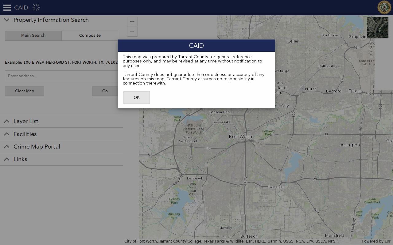
Use the map only to collect public parcel identifiers, then confirm owner and instrument details in TAD and the Clerk index. CAID describes its map as general reference information that may be revised without notice, so a boundary line or owner-layer label needs a dated source note.
CAID layer-service fields can include owner name and address, owner ZIP and ZIP+4, situs address, TAXPIN, account, TAD map, exemption, and legal-description fields. A polygon proves adjacency on a map, not a personal relationship between people connected with adjoining parcels.
Note: Record the map layer and access date because GIS fields can be revised after a parcel or address search.
Saginaw Street Records by Address
Each record set answers a narrower question than a street directory suggests. The parcel and tax records help locate an owner or account. The deed index describes recorded real-property activity. A city request may supply a permit or code chronology. The voter lookup confirms a known registration, but the public web tool does not offer a street-wide browse of every registered voter. Use the access channel that matches the question and preserve the limits beside the result.
| Address record | Saginaw custodian | Useful fields | Documented access |
|---|---|---|---|
| Appraisal parcel | Tarrant Appraisal District | Owner, mailing address, situs, legal description, account, site number, instrument | Free property search |
| Parcel map | Tarrant County CAID | Parcel geometry, TAXPIN/account, situs, owner layer, district and map clues | Free GIS viewer |
| Recorded instruments | Tarrant County Clerk | Grantor, grantee, recording date, legal description, liens, plats, image route | Online index, account download, room B30, mail, or paid certified copy |
| Tax account | Tarrant County tax office | Owner, mailing or property search, active status, payment context | Tax search |
| Permit or code file | City of Saginaw | Permit, inspection, notice, photo, correspondence, or case status when releasable | Address- and date-limited city request; no public search index confirmed |
| Historic directory | Regional libraries and archives | Dated occupant, business, and sometimes owner or renter notation | Physical volumes, microfilm, digitized images, and archive help |
The Tarrant County Clerk’s online index supports term, recorded-date, document-type, subdivision, and instrument searches. An account sign-in permits free unofficial watermarked downloads; certified copies are paid. For a failed online search, the Clerk’s Central Library room B30 provides public kiosks and staff assistance on weekdays from 8 a.m. to 5 p.m., and the county documents mail and copy options. Older direct and reverse deed indexes from 1876 to 1968 are a separate archive route rather than a promise of complete online coverage.
Follow Saginaw Street Deed Chains
A street-level ownership trail begins with the latest instrument, not a broad name search. In the County Clerk portal, search the current owner as grantee or use the instrument number from the TAD card. A deed identifies grantor and grantee, a recording date, an instrument or volume and page, and a legal description. Search the seller from that deed as a grantee in the earlier period, then repeat. The legal description often survives a changed postal label better than a street number.
A grantor transfers an interest and a grantee receives it. Neither role establishes a move-in date. The County Clerk does not perform title or lien searches, so the sequence is a source-backed research trail, not a title opinion. If the modern portal stops, consult the historical deed indexes, Tarrant Archives ledgers, Portal scans, microfilm, or the Clerk’s copy desk before treating a missing result as a gap in ownership.
For a past household rather than title history, regional volumes belong on the Saginaw Directory Book route. A directory street page can add an occupant snapshot, but its regional coverage is discontinuous and must be checked by volume and page.
Request Saginaw Street Files
Building and code records can add a property chronology when parcel and deed records leave a question unanswered. Saginaw Building Inspections & Permits at 301 S Saginaw Boulevard handles construction-code enforcement and nuisance abatement. Its published counter hours are Monday through Thursday, 7 a.m. to 5:30 p.m., and the inspected material did not reveal a public address-level permit database. Contact the office or use the city’s public-information channel instead of assuming that a web search is complete.
Send the City Secretary a narrow request under the Texas Public Information Act: the exact address, a date range, the department, and the record category. Ask for an electronic copy when possible. For code compliance, identify whether the request concerns a permit application, inspection result, certificate, nuisance complaint, photograph, notice, hearing record, or closure. An applicant or contractor shown in a municipal file is not automatically the owner or resident.
Code Compliance documents can include reports, correspondence, legal papers, photographs, and factual findings, subject to lawful exceptions and redaction. The city’s Building Inspections & Permits and Code Compliance pages are the current contact routes.
Check Saginaw Street Voter Records
The Tarrant voter tool is a confirmation channel for a known person, not a public web roster for a whole Saginaw street. Its required lookup keys are last name, first name, and date of birth, with State Voter ID as an alternative. A result can show name, address, status, county and state voter IDs, precinct, districts, and election history. It does not reveal ballot choices.
Texas Election Code rules make some voter information public while protecting Social Security, driver-license, and certain residential-address information. A protected voter may not appear like an ordinary result. The full voter file was not exposed as a simple public download during research; ask Tarrant Elections for its current request format, price, and use conditions rather than promising a ZIP or street export. The office publishes its contact route at Tarrant County Elections.
Note: A voter hit can support a dated address check, but it does not identify every person who lives at that address.
Read Historic Saginaw Street Pages
Older address evidence is regional. The Texas State Library lists Fort Worth directory runs from 1877 to 1989 in selected years and Fort Worth Suburban volumes from 1963 to 1993. A finding aid describes criss-cross coverage from 1930 forward, while the precise Saginaw inclusion and volume must be verified before a search is treated as complete. The Fort Worth History Center offers local-history and genealogy material by appointment, and Tarrant County Archives adds directories, maps, school records, cemetery material, and historic ledgers.
A criss-cross directory reverses the usual name-first arrangement: it sorts an address or street page to a surname or business. Start with the street guide or householder page, retain direction and cross-street abbreviations, then record the title, publisher, year, page, and whether a transcription came from OCR or an image. The digitized 1916 Fort Worth volume at the Portal to Texas History is an accessible example of why the page image should be checked against OCR.
Saginaw Street Labels and ZIPs
Postal labels, municipal geography, and parcel fields do not always match. Saginaw City Hall uses 76179, while Saginaw High School uses a Saginaw address in 76131. The TAD sample also pairs a Saginaw situs with a Fort Worth mailing city. These are reasons to preserve all returned values, not reasons to overwrite one with another.
For current work, USPS standardizes a mailing address, TAD and CAID locate the parcel and property city, and the Clerk’s legal description follows the land. For an older record, search Dido as well as Saginaw. The settlement was renamed Saginaw in 1882, and the post office followed in 1888, so a historic deed, directory, or local description may not use a modern city label. The Saginaw ZIP Codes lookup explains the postal split in detail.
Define Saginaw Street Record Terms
Address records use several different locators. Reading them as separate fields makes a Saginaw street-record result easier to test across a map, appraisal card, and deed image.
- Parcel
- A mapped piece of land or property account. A parcel polygon locates land, not every person connected with it.
- Situs address
- The physical property address used to locate the parcel. It can differ from the owner’s tax mailing address.
- Plat
- A recorded map that lays out lots, blocks, streets, or easements in a subdivision.
- Legal description
- The title locator, such as subdivision, block, and lot, used in deeds and often more stable than a printed street address.
- Criss-cross directory
- A reverse directory arranged by address or street, used to find a dated name or business from a location.
Rancho North Addition, Block 24, Lot 22 and the linked georeference in the inspected TAD sample demonstrate why a block-and-lot key can bridge city-label or street-format differences. Use the original spelling from the deed or map rather than forcing it into a present-day format.
Limit a Saginaw Street Directory
Street research has firm edges. A parcel owner can be a trust, estate, business, attorney, or former correspondence contact. Renters, other household members, utility customers, delivery recipients, and DMV address holders are not a complete public street layer. The statewide address confidentiality program and voter-address protections can also limit what appears in a public record. A missing web result is not proof that no person is associated with an address.
Lawful personal use. Use Saginaw street records for careful personal, family-history, estate, or civic research. Do not use an address, parcel, voter, or directory result to stalk, harass, intimidate, or harm any person.
For protected-address questions, the Texas Address Confidentiality Program explains the substitute-address program. Custodian records may also contain redactions. Preserve that boundary when comparing sources and do not fill a gap with an assumption.